

At the weekend I walked along Wick Road with Natalie from Hackney Cyclists, making notes on detailed design issues related to the Wick Road scheme. Here are some detailed comments and suggestions, based on this visit. Hackney Cyclists have put a discussion thread about the scheme up on Cyclescape and are developing their own response.
To reiterate – putting cycle tracks along this busy B-road is a great idea, and necessary to start unlocking the area’s suppressed cycling potential. But there are some problems. These don’t detract from the principle, but they do mean some rethinking will be needed in the detailed design stage.
The design isn’t perfect, but with some – often relatively simple – changes, it could be really good. The cycle track must be of sufficient width (1.5m is minimum, not desirable width), machine laid, and be clearly separated from the footway. (I’m glad Hackney say they will develop a design that considers the needs of visually impaired pedestrians – I hope they’re also speaking to Wheels for Wellbeing, who advocate for inclusive cycling and have experience of considering the needs of disabled cyclists in the context of the needs of disabled pedestrians). Where it’s next to the carriageway, a stepped track could work well.
First a couple of general comments. Wick Road feels very motor dominated, with two lanes of often busy motor traffic and lots of footway parking. This despite most people living close to Wick Road not owning a car. We saw some scary driver behaviour – including one driver illegally turning into Bradstock Road at speed, and another trying to turn illegally into Wick Road itself eastbound from Morning Lane (then when she realised she was about to drive head on into another car, she quickly reversed and sped through the pedestrian green light on Kenton Road instead!)
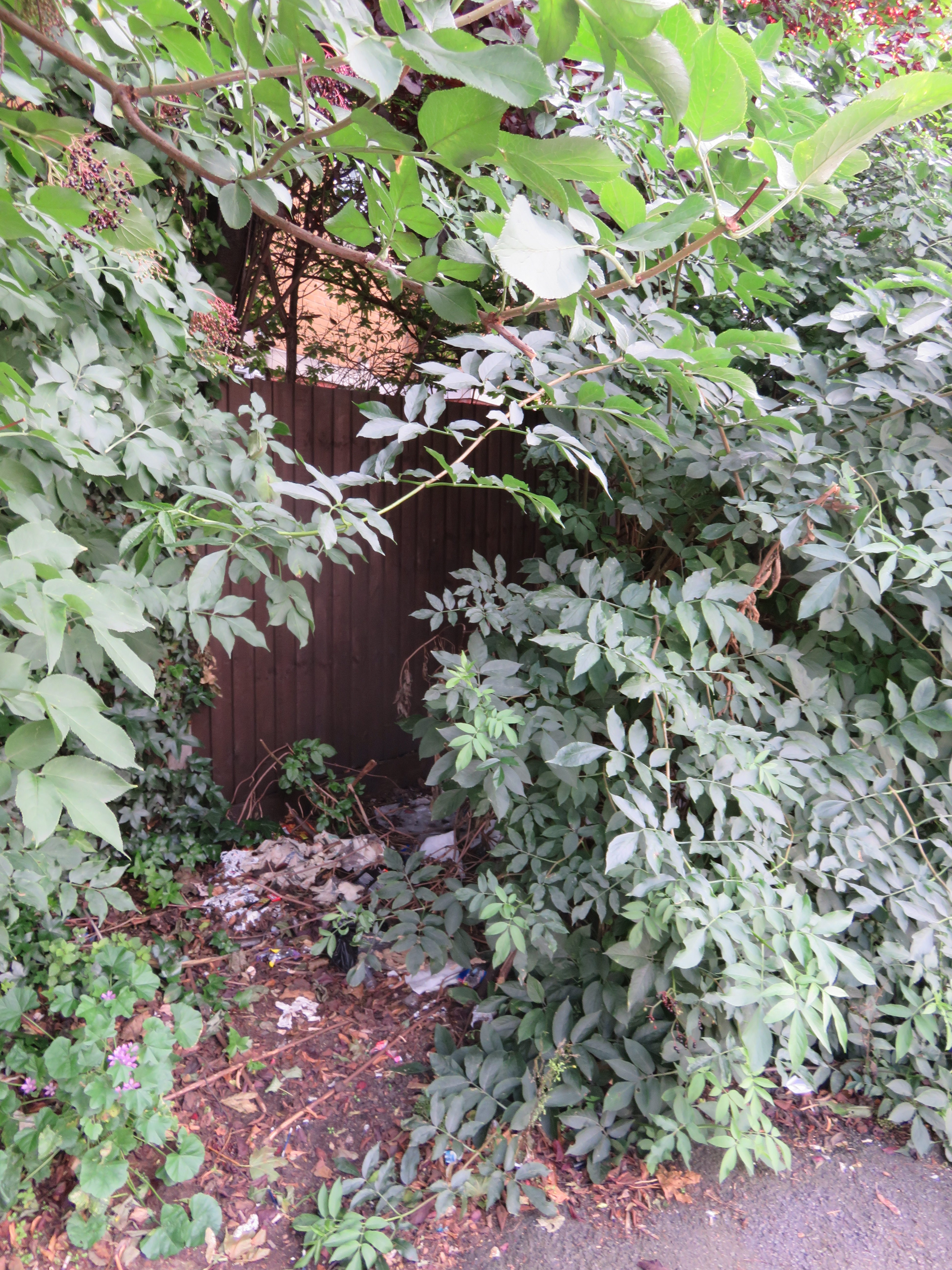
Unloved greenery
There’s unloved bushes/weeds teeming with uncollected rubbish, particularly at the East end.
Woman and child cycling Eastbound, Wick Road
Secondly, I was surprised by just how much cycling there was already along Wick Road, given the hostile surroundings. Most on footways. If you’re riding East at the moment then – apart from the short section of two-way track – you can’t legally ride anywhere, carriageway or footway. Riding West you could be on the road; but most people understandably weren’t.
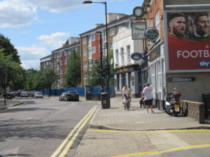
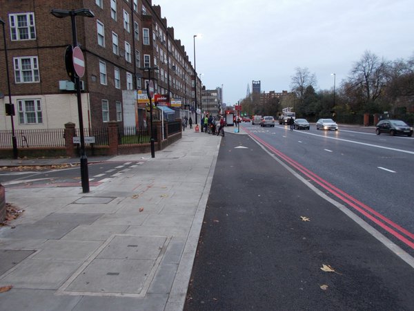
East end of the scheme
We started at the East end of Wick Road.
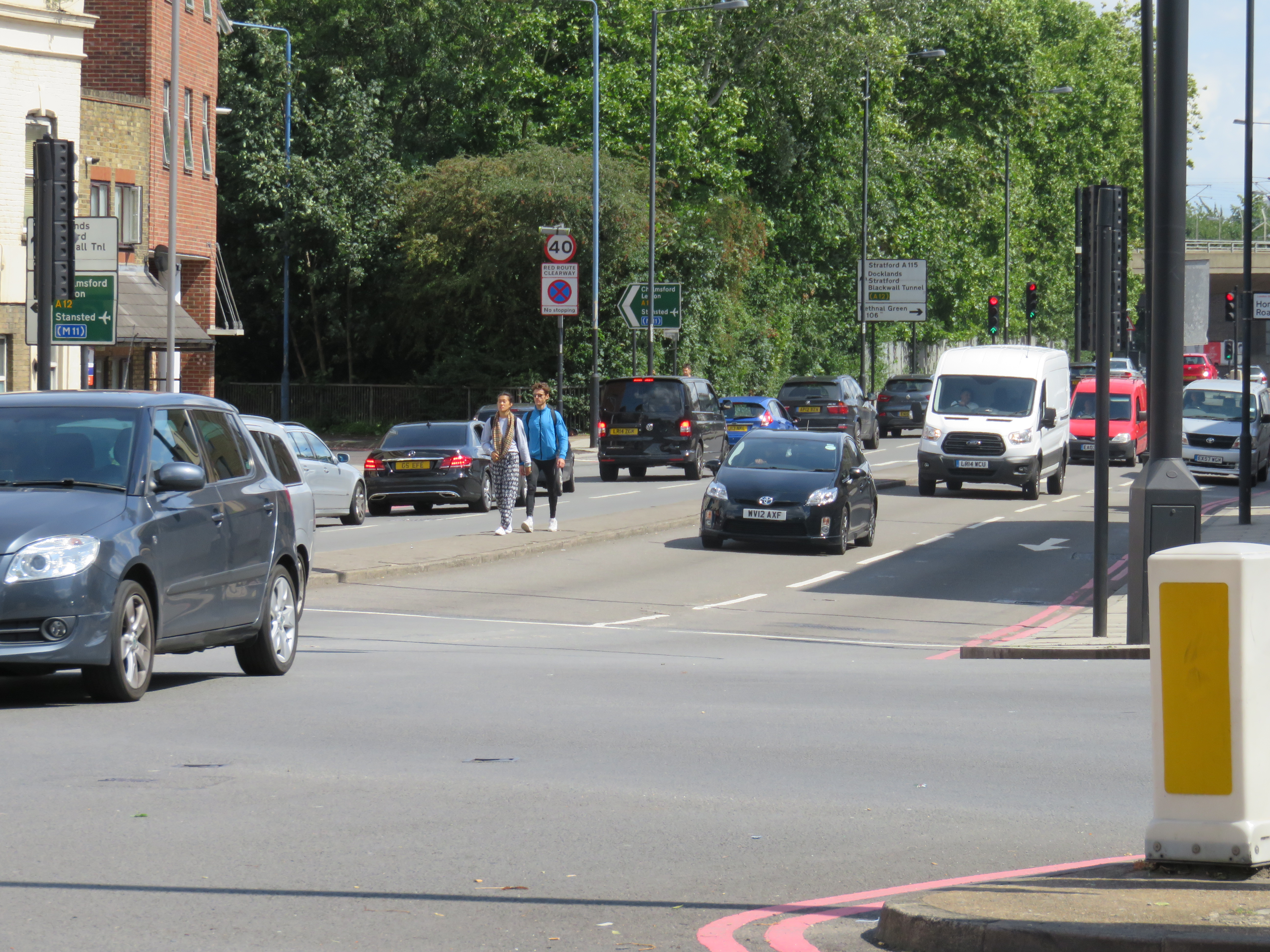
Wick Rd, junction at East end of scheme
The five-armed junction here is a complete nightmare. It looks like the pedestrians in this image have got stuck on the central reservation, trying to cross Wick Road just East of the junction. There are no changes proposed to this junction to make it safer. This is understandable to an extent as it’s a Transport for London junction; Wick Road beyond the junction is a TfL road. So Hackney Council can’t themselves remodel it as part of the scheme (it would have been nice had they been talking to TfL over the past 2 years about this – maybe they have but have not got anywhere…?) Here we need proper separation rather than throwing cyclists into a motorway-type situation (that’s a slip road you can see just behind the pedestrians).
But in the interim, why not try a quick fix? Without remodelling the junction, we could provide shared space and toucan crossings to get people over from the bike tracks to Brookfield Road. It wouldn’t be perfect but it would allow a legal and safe continuation.
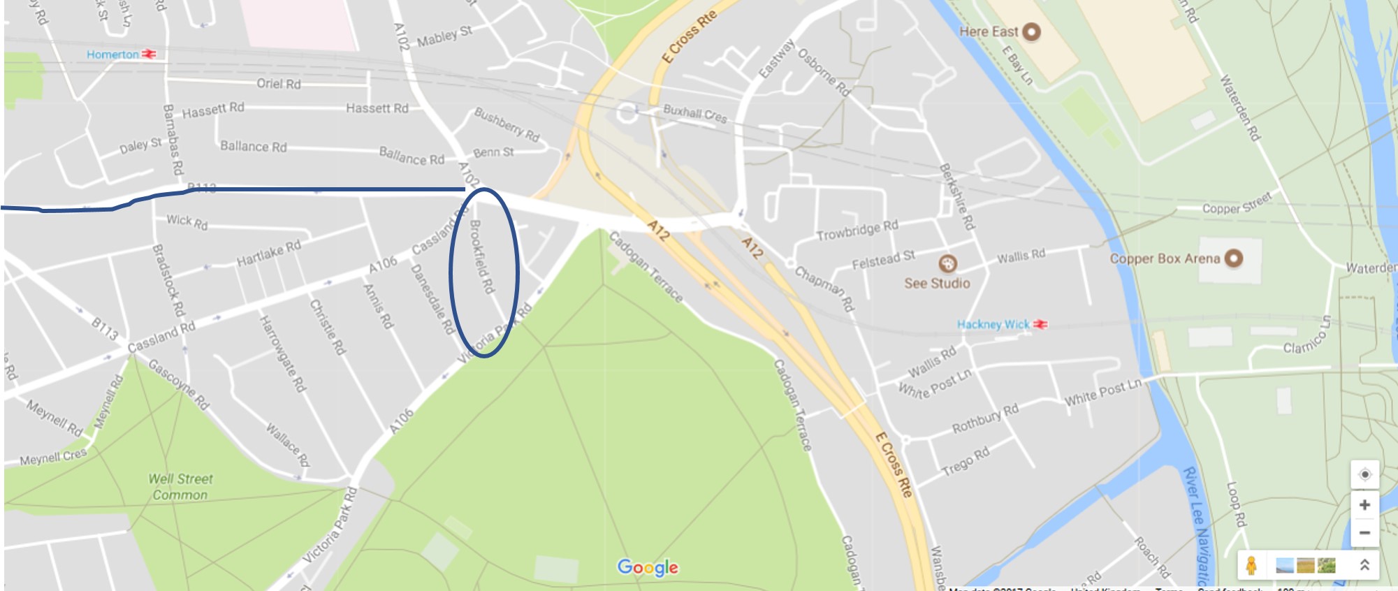
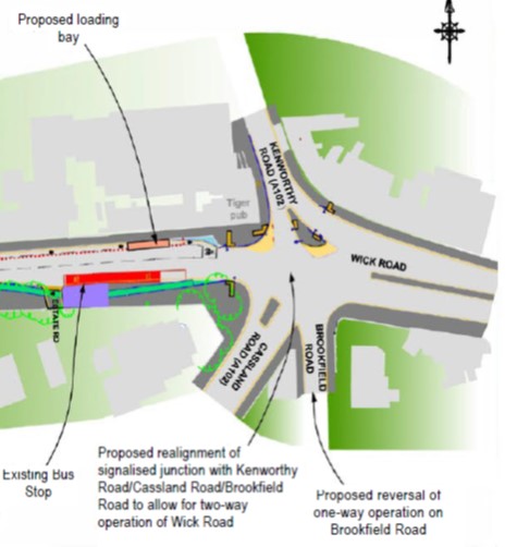
Wick Road scheme and Brookfield Road
Currently Brookfield Road is going to switch from one-way Southbound to one-way Northbound, with turn restrictions. But why restrict cycling, when this link could take people quickly to Victoria Park and beyond in relative safety? We could make Brookfield Road two-way for cycling, and use toucans to facilitate cyclist movement between it and the tracks. Note on the picture (i) Victoria Park, just South of Wick Road, (ii) the estates just East of the East Cross Route, which suffer severely from severance (where major roads or other infrastructure block cyclist and pedestrian desire lines) and (iii) the green space, homes and jobs of the Olympic Park further East. Even with this scheme, all these remain cut off. Doing something now to facilitate cycle movement along Brookfield Road could help in the short term, in an area long blighted by the M11 link road. Imagine it – GPs at Wick Road’s health centre could prescribe patients a bike ride along the Wick Road tracks to Victoria Park, over the ped-cycle bridge over the motorway link, up the river or through the Olympic Park.
The lead up to the junction shows a lack of ambition. Eastbound cyclists are kicked into the carriageway and join a loading bay, when the stepped tracks could continue here.
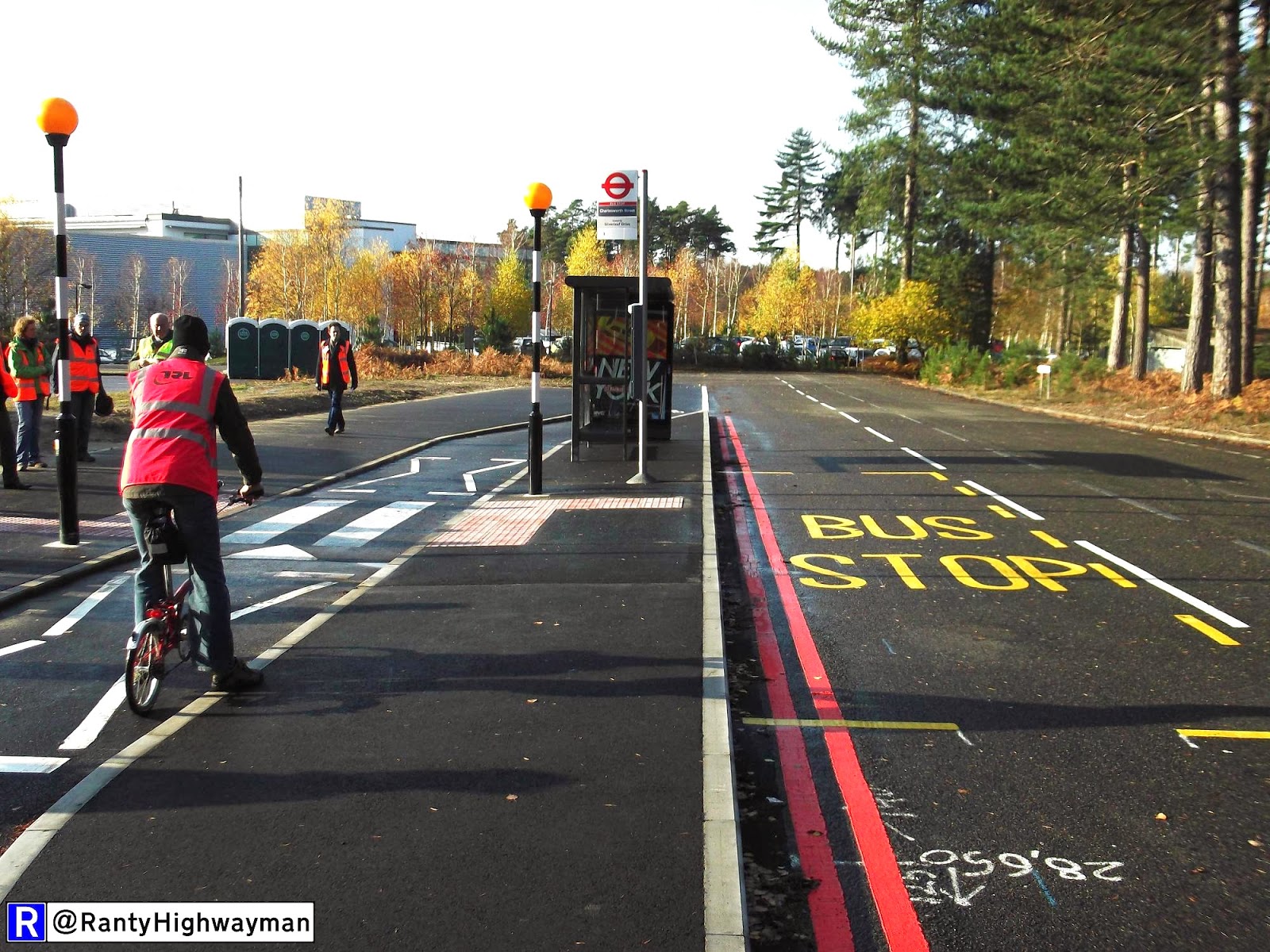
Bus stop bypass with zebra
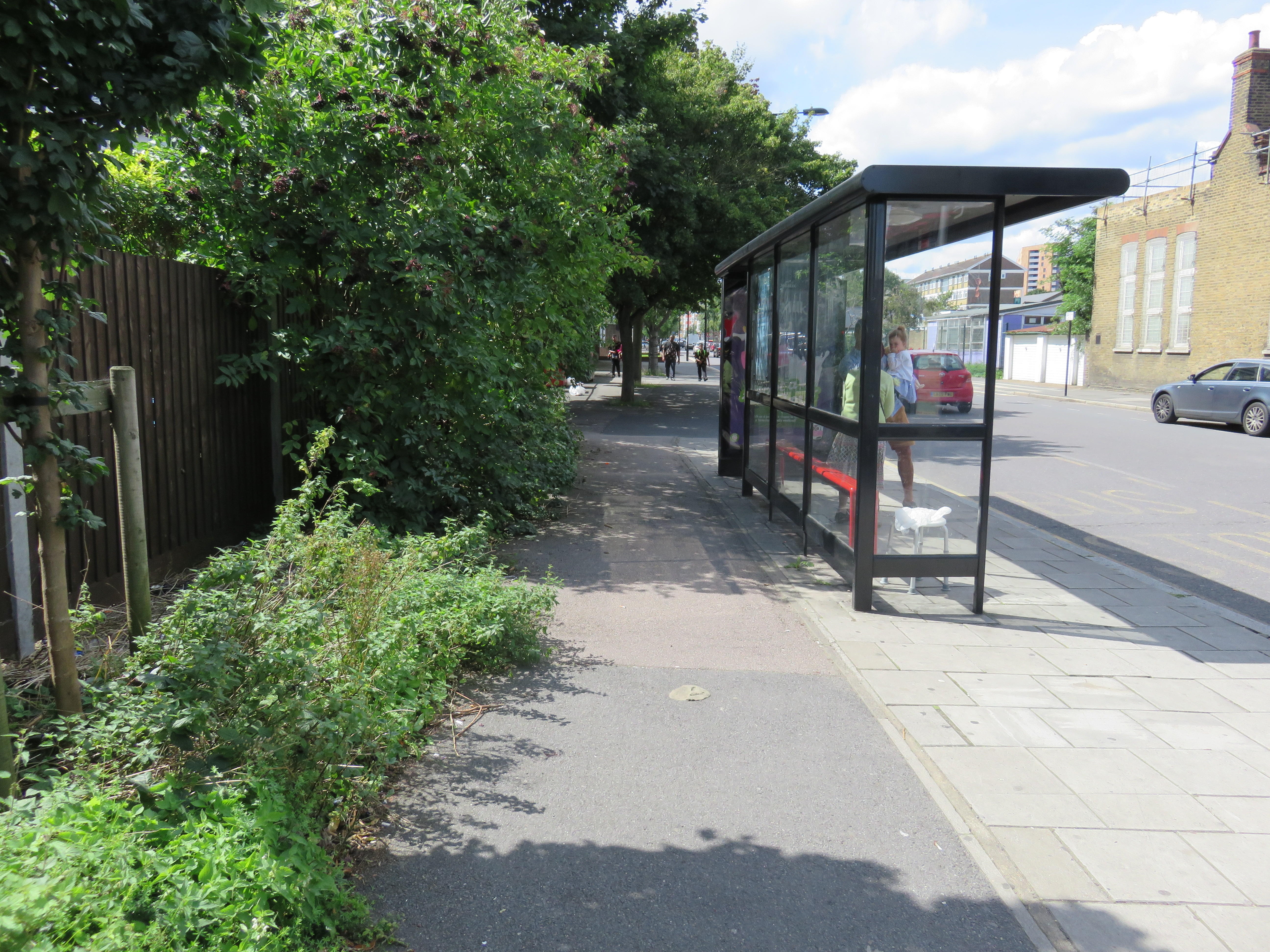
Bus stop, South side of the East end of Wick Road
Westbound, the track starts immediately, but soon hits the purple blodge on the map – shared space around the bus stop. There’s enough room here, though, for a proper bus stop bypass, which would give pedestrians clarity about where cyclists will be – particularly important for more vulnerable pedestrians. Zebras (no need for beacons) could be used to give pedestrians priority when crossing the tracks.
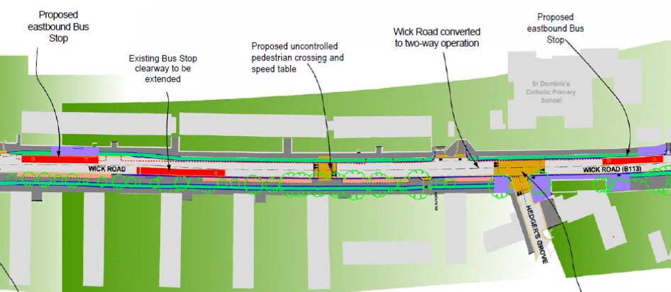
Wick Road, middle section (1)
The next section of Wick Road (moving Westwards) is a mixed bag.
First, the good bits. Most of the South side looks lovely. Well done Hackney. Two things that need fixing, though.
Continuous footway and cycleway (image: Ranty Highwayman)
Firstly, at Hedger’s Grove – why plump for shared space and a raised table, when you could provide a continuous, delinated footway and cycleway over the side road junction? (I’d suggest retaining tactile paving to alert visually impaired pedestrians to the side road). Much clearer priority for walking and cycling, and more attractive.

Prioritise walking and cycling here.
Secondly, this. At Wick Road Health Centre suddenly the previously wide footway becomes very narrow and we get shared space. This is in order to preserve a square of grass in front of the health centre. Could Hackney negotiate to take over some of that grass, in order to separate cyclists and pedestrians here, and reduce conflict? It seems to me more important to facilitate comfortable active travel here.
Car park entrance: continuous footway and cycleway here, please
On the North side of Wick Road, things are less good. At one point the track disappears at two entrances to (restricted) car parking – again why no continuous footway/cycleway?
There is also an issue with the proposed Eastbound bus stop, near Barnabas Road. Here there may not quite be room, on the current alignments, for a proper bus stop bypass. But that doesn’t mean shared space – as currently proposed – is a good idea. Looking at the drawings, Natalie and I thought that setting the bus stop 2-3 feet into the carriageway would provide that space; or moving kerb lines (the footway on the other side is wider) would be another option. Or negotiating to move back the grassy area slightly.
Site of proposed Eastbound bus stop.
One final issue in this section. The ‘proposed uncontrolled pedestrian crossing’. Why not make this a zebra – in fact, as Natalie suggested, why not go further and make it a tiger crossing as seen elsewhere in Hackney?

Tiger crossing on Richmond Road, Hackney (photo: LCC)
When this track is built, particularly if we can sort out continuity either side, there will be plenty of people wanting to access it from estates either side of the road. Allowing them to safely cross to their desired side of the road will reduce wrong-way cycling, and associated annoyance for other cyclists and pedestrians.
If Hackney Council think the design means drivers are going to stop for pedestrians anyway, why not formalise this and give vulnerable pedestrians – and cyclists – the confidence they need to cross? If not, there’s an even greater need for a tiger/zebra.

Wick Rd middle section (2)
Now onto the second middle section. Mostly, the track again looks nice. But here’s two junctions: Barnabas and Bradstock, which are rather a mess. Firstly Bradstock, heading South. Why the shared space that stops at the side road carriageway? Why not continue the footway and carriageway over, to give pedestrians and cyclists priority?
Barnabas also needs re-thinking. Cyclists are put on the carriageway, rather than the – hopefully stepped – track continuing either side. But the tracks can continue. It looks like there’s enough room (as before, it’s a little hard to tell on the plans), so why go for an on-road lane and Advanced Stop Lines? The consultation text reads ‘Advanced cycle stop lines will be installed at each junction to ensure that people on bicycles are in front of motor vehicles at red lights.’ But will people really want their kids, cycling to school on the tracks, to be then placed in front of motor vehicles at this junction?
Tracks at the Barnabas Rd junction please, not on-road lane and ASLs…
It would be much better to continue the tracks and allow cyclists to continue to be separated from motor traffic at this signalised junction. Going Westbound it’s straightforward, as there’s no conflicts with motors. (Instead, Westbound cyclists are given a choice between swerving onto the road into an ASL before (presumably) bunny-hopping back onto the track once through the junction, or having the track and footway turn into shared space. Eastbound, on the other hand, it’s into the road for kids and ‘hardened commuters’ alike). Peering closely at the plans, it looks like motor vehicles won’t be allowed to turn left into Barnabas Road from Wick Road. (See “Ahead Only” marked on the lane Eastbound, which is next to what looks like a 1.5m on-road cycle lane). In which case, there would be no left-hook risk for cyclists going straight on Eastbound.
There’s also another uncontrolled crossing on this section, which again I’m sceptical about – I’m less sure than Hackney Council is that turning this road two-way for motors will eliminate the poor driver behaviour I see regularly here.

Wick Road, West End
Onto the final section. Here the track and footway continue over the estate road on the South side – good stuff – although again there’s shared space at the bus stops, even though it seems like there’s enough space for bypasses (certainly is on the South side).
But the junction.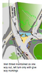
This junction’s being reconfigured, and doesn’t include any TfL roads – it’s all Hackney roads. What’s being done? “Well Street maintained as one way out, left turn only”. For bikes, and for motor vehicles. What a missed opportunity. Well Street here is basically the continuation of Wick Road, and moreover has shops, restaurants, grocers, cafes, bars, supermarkets and a weekly market. Many people cycling along the new Wick Road tracks will want to go to Well Street – both as a destination and to avoid joining the unpleasant and scary B113 (Morning Lane).
Instead, anyone coming from Well Street by bike will have to turn left into Morning Lane, rather than continue along the Wick Road tracks, while anyone cycling Westbound along the Wick tracks can only turn left or right along the B113. What we really need here is a proper protected ‘Dutch’ junction.At the minimum – and I appreciate schemes have boundaries, and while the B113 needs urgent improvement this scheme’s not the place for it – we need to facilitate people cycling from Well Street to Wick Road, and vice versa.
You could actually do this quite easily. At the moment many cyclists (myself included) going Eastbound along Well Street will join the footway to the right, and cross over with pedestrians. Make the footway area shared, and the crossing a toucan (leading to the Wick Road tracks – which will need to be continued over Flanders Way) and this manouevre becomes legal: you’ve solved the Eastbound problem. Westbound, the Kenton Road crossing could be moved nearer to the junction, and become a toucan allowing Westbound cyclists to continue legally to the shared footway and then on up Well Street (which could become two-way for cycling). Not perfect, but a simple way to solve what will otherwise become a major block to cycling – why build a cycle track that doesn’t offer a way to proceed to and from its continuation, a relatively quiet street that’s also a major desire line and destination?
When I respond to the consultation, I’ll be strongly supporting the principle of the tracks, but making it clear that the – mostly quite minor – changes above are meeded to ensure their transformative potential.